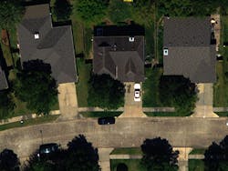
Modular imaging system developed for flight
Engineers at MaxVision (Madison, AL, USA) and Visual Intelligence (Houston, TX, USA) have teamed to create an airborne digital sensing and image processing system for use in aerial surveillance on manned and unmanned air vehicles (UAVs).
Leveraging commercial off-the-shelf (COTS) technologies to reduce costs, the modular architecture of the Iris One system allows it to be customised to address different sensing applications.
For example, the Iris One architecture can accommodate color and near infrared camera modules, while other types of imaging systems -- such as hyper-spectral and thermal systems -- can be configured via plug-and-play hardware and software modules.
The modular architecture of the system -- which is based on MaxVision’s MaxCube II Compact Mobile Super-Server -- also allows users to enhance individual parts of the system, such as swapping in higher resolution cameras to improve resolution and data collection capacity -- as required.
The Iris One hardware is complemented by the Iris Sky and Isis Earth software applications. Iris Sky provides in-flight ortho processing, while Isis Earth provides ground-based post-processing capabilities used to generate even more accurate ortho images.
-- by Dave Wilson, Senior Editor, Vision Systems Design
