September 2016 snapshots: Recon robot, aerial crop monitoring, vision inspects hail damage
Reconnaissance robot uses IR cameras to detect threats
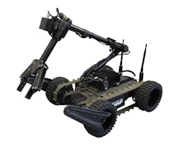
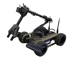
Designed for military reconnaissance teams to detect threats, including those at locations not accessible to human beings, the FENIX robot from PIAP (Warsaw, Poland; http://antiterrorism.eu) measures 23.62 x 19.68 x 7.4in and can observe, lift, and neutralize dangerous loads or transport equipment. Equipped with an XTM-640 thermal imaging camera core from Xenics (Leuven, Belgium; www.xenics.com), the IR camera features a 640 x 480 uncooled microbolometer with a spectral band of 8-14 μm and a 100mm LWIR lens.
FENIX also employs a visible spectrum camera, which along with the IR camera, is mounted on a pan-tilt unit on the manipulator arm of the robot. The robot is controlled wirelessly or over an optical fiber link and displays and records images on a handheld control panel. This also provides access to camera position and system parameters, allowing users to adapt the robot as required.
FENIX's 40lb robot's chassis is equipped with tracks and wheels with moveable front flippers, which ensures that the vehicle can operate on hardened and dirt roads with inclines up to 45°. Furthermore, the hybrid track-wheel mechanism enables users to remove the wheels and front flippers to reduce the height and width of the robot, making hard-to-reach areas more accessible. The robot has an open-field range of more than 1,640ft and top speeds of 6mph.
Scientists develop aerial crop monitoring system
Scientists from the ETH Institute of Agricultural Sciences' Research Station (Lindau, Switzerland; http://www.ias.ethz.ch/research.html) have developed a vision system that is used to measure and monitor the health and performance of crops.
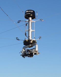
The system was inspired by the aerial "spider cams" suspended above football stadiums, which provide a "bird's eye" view of the pitch for television viewers. In the system developed at ETH, four masts, each one 24m high, are positioned at four corners of a plot measuring 100 x 130m. Between the masts, cables carry a moving sensor head with multispectral cameras, an IR camera, two spectrometers and a laser measuring device 7m above the ground. Electric cable-winches at the foot of the masts adjust the lengths of cable between the sensor head and masts, allowing the sensor to be positioned anywhere above the plot, without touching the ground or disturbing the crops.
Developed to discover the differences between individual plant varieties, to determine how long they need to flower, and to discover the relationship between growth, ambient temperature and soil moisture, the system is used to study numerous plots consisting of different varieties of wheat, soy, maize, buckwheat, and forage grasses. Additionally, the system allows the team to investigate whether, or how, fungal diseases develop on the crops and to monitor weed cover on the ground.
"In ten years' time farmers will be supported by a range of systems capable of identifying diseases and provide information on the potential use of crop agents," says Achim Walter, Professor of Crop Science at ETH Zurich. "This system enables us to discover what future challenges need to be tackled and which tasks can be delegated to machines."
Multi-camera system inspects cars for hail damage
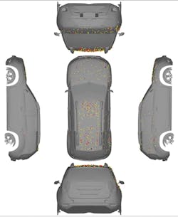
To more quickly and efficiently inspect vehicles for hail damage, thus accelerating the insurance claim process for vehicle owners, Adomea (Bochum, Germany; www.adomea.com) has developed a portable multi-camera vision system dubbed MIKo. Using seventeen cameras mounted in different positions to capture the entire exterior of a vehicle, the system captures reflection patterns of the vehicle's surface and processes them to return an objective measurement to the user.
To detect small irregularities and distortions on the surface, the system uses both Manta G-609 GigE and Manta G-917 GigE cameras from Allied Vision (Stadtroda, Germany; www.alliedvision.com). While the Manta G-609 GigE camera features a 6Mpixel ICX694 CCD from Sony (Tokyo, Japan; www.sony.com), the Manta G-917 GigE camera employs the 9Mpixel ICX814 CCD. Because the cameras both feature PoE, each camera only requires one cable.
All of the cameras are synchronously controlled using the Precision Time Protocol (PTP) and together generate an image of the vehicle being examined. Using Allied Vision's Vimba software development kit, damage analysis software developed by adomea allows individual dents to be subdivided according to shape and depth. A visual representation of the damage is then generated in a damage report. Using the system, a complete damage assessment can be performed in approximately five minutes.
How much the entire damage assessment, calculation, and regulation process can be completely digitized is currently undergoing lively debate throughout the insurance industry. Currently, the scanner serves to support insurance evaluators and has not completely replaced manual evaluation.
Adomea is already developing new models of the system and is planning to use a 29Mpixel camera to detect smaller surface flaws such as scratches and rock impacts in addition to the hail damage.
Unmanned vehicle provides surveillance and surveying capabilities
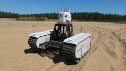
To perform surveillance and surveying, Milrem (Tallinn, Estonia; http://milrem.ee) and Leica Geosystems (St. Gallen, Switzerland; http://leica-geosystems.com) have collaborated on a vision-guided unmanned ground vehicle (UGV) called Pegasus:Multiscope. The system combines Milrem's Multiscope UGV and Leica Geosystems' Pegasus:Two mobile mapping sensor systems that feature eight cameras each with 4Mpixel CCDs that can capture images at 8fps. The cameras use 8mm focal length lenses and provide a 360° x 270° FOV.
Designed for off-road use in surveying, security, and monitoring applications, the UGV is capable of travelling at speeds of 15-22mph. The system weighs 1,985lbs and can carry a payload of 1,655lbs. The UGV runs on a diesel generator, Li-Ion battery packs, and graphene ultra-capacitors that allow for up to 10 hours of nominal work use.
Pegasus:Multiscope was developed with the intended use of commercial and government applications including civil engineering and security applications. The UGV's low ground presssure (0.98psi - 1.635psi) enables it to traverse various terrain including mud, sand or snow. When combined with the Pegasus:Two's multiple sensor options, the system cana be deployed for automated border patrol, where the Pegasus:Multiscope can follow a pre-programmed route and detect disturbances.
