Hyperspectral imaging system grades ore quality at coal and gold mines
Researchers from the School of Mechanical and Mining Engineering at the University of Queensland (Brisbane, Queensland, Austraila; www.uq.edu.au), in collaboration with the Minerals Research Institute of Western Australia (MRIWA) (East Perth WA, Australia; www.mriwa.wa.gov.au), mining technology developer Plotlogic Pty Ltd. (Bowen Hills, Queensland, Australia; www.plotlogic.com), Citic Pacific Mining company (Perth, Australia; www.citicpacificmining.com), and global gold mining company AngloGold Ashanti (Newtown, Johannesburg, South Africa; www.anglogoldashanti.com), developed a hyperspectral imaging system to generate terrain and ore grade maps and support the development of autonomous mining excavators.
As detailed in a report titled, “Real-time mining face grade determination using hyperspectral imaging techniques,” (bit.ly/VSD-HYPMIN) current methods for determining the quality of ore at the mining face, or the exposed surface of an ore deposit, leave much to be desired by the mining industry. The position of the mining face necessarily changes over the course of extraction, which makes multiple face grade determinations desirable. However, current face grading techniques depend on drilling and destructive tests that take time to complete, result in loss of ore, and lack precision.
The OreSense system addresses these concerns. It uses a HySpex (Skedsmokorset, Norway; www.hyspex.com) VNIR-1800 camera that covers the 400 to 1000 nm wavelength range, a HySpex SWIR-384 camera that covers the 1000 to 2500 nm range, and a Velodyne (San Jose, CA, USA; www.velodynelidar.com) VLP-16 LiDAR scanner used to generate 3D point clouds of the mining face. The cameras and scanner, encased in a sensor head mounted on a pan-tilt unit, and the rest of the system mount on the back of a stationary vehicle.
Three global navigation satellite system (GNNS) receivers with real-time kinematic (RTK) corrections orient the system by geolocating the terrain model built by the LiDAR scanner. Doing so allows the assignment of GPS coordinates to every point on the terrain map to pinpoint the locations where hyperspectral data is gathered, allowing the OreSense system to marry the hyperspectral and 3D scan data. The optimal scanning distance for the system is 30 m.
The LiDAR scan takes place first to make sure the terrain scan captures the entire area of interest and allow the operator to make corrections. The pan-tilt unit then pans across the area of interest as the hyperspectral cameras conduct their line scans. This process takes place over a small portion of the scene to make sure the hyperspectral cameras capture information in the desired wavelength range. After making any necessary adjustments, the hyperspectral cameras then image the entire mine face.
The use of sunlight vs. the usual, preferred illumination sources for hyperspectral imaging such as halogen lights or broadband LEDs presents a challenge for processing the hyperspectral data, state the researchers. Atmospheric conditions such as humidity, for example, present a challenge as water vapor absorbs some wavelengths of infrared light. The OreSense system can be programmed to account for these variables via the use of filters when processing the hyperspectral data.
Finally, each pixel in the image is labeled with hyperspectral information and a convolutional neural network (CNN) classifies the labels for each pixel. The CNN trains on labeled data gathered from ore samples of known grade, chemical assay values, or field surveys with confirmed ground-truth values.
During tests at the Citic Pacific Sino Iron Ore Project and the Tropicana Gold Mine, both located in Western Australia, ore samples were taken from each site, illuminated with halogen lights, and imaged with hyperspectral cameras. The wavelength filters designed for the prototype system to filter out noise caused by atmospheric conditions were used for imaging the ore samples to make sure the same number of spectral channels were used in the test and ground truth hyperspectral data collection.
After comparing the ground truth data to the ore grading results determined by the CNN’s analysis of the hyperspectral images gathered by the OreSense system, the researchers determined that the system successfully provided useful ore grade information. Furthermore, the experiments established the proper workflow to deploy the system at new sites. A patent for the technology has been filed.
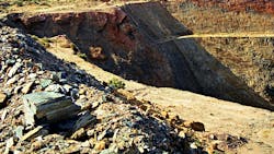
Image "6 February 1998 - Fraser's open cut gold mine at Southern Cross, Western Australia" by aussiejeff is licensed under CC BY-SA 2.0 /cropped from original
About the Author

Dennis Scimeca
Dennis Scimeca is a veteran technology journalist with expertise in interactive entertainment and virtual reality. At Vision Systems Design, Dennis covered machine vision and image processing with an eye toward leading-edge technologies and practical applications for making a better world. Currently, he is the senior editor for technology at IndustryWeek, a partner publication to Vision Systems Design.
