AEye's LiDAR System Chosen for Moon Rovers
Key Highlights
- Apollo is a compact, rugged, software-defined LiDAR sensor designed for long-range object detection in demanding environments.
- The system features a MEMs-based scanning mechanism that withstands severe impacts, large thermal swings, and vacuum conditions, making it suitable for lunar deployment.
- The development of space-hardened LiDAR technology is expected to benefit terrestrial applications such as autonomous vehicles driving in adverse weather and hazardous conditions.
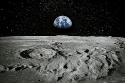
An advanced software-based LiDAR system developed right here on Earth will soon be helping astronauts drive on the moon. Lunar Outpost (Golden, CO, USA), a company that specializes in developing and building rovers, space robotics, lunar mobility systems, and other technologies for NASA’s Artemis-era lunar exploration efforts recently chose AEye Inc.’s (Dublin, CA, USA) Apollo long-range LiDAR platform for integration onto the Pegasus Lunar Terrain Vehicle.
NASA is expected to receive delivery of the Pegasus LTV in 2027 and to deploy it in 2028. Its mission will be to transport astronauts and cargo around the South Pole region of the moon, according to NASA. Lunar Outpost CSO Forrest Meyen said Lunar Outpost selected Apollo for its rugged, robust solid-state design, software-defined architecture, and compact form.
“Space mobility is a new market opportunity for AEye, and the lunar environment represents the most demanding proving ground any sensor can face: no atmosphere, no margin for error, and no opportunity for in-mission repair,” AEye CEO Matt Fisch said.
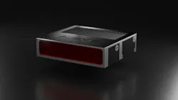
What is Apollo? It's a software-based LiDAR sensor designed for long-distance object-detection applications across a variety of industrial sectors, including automotive safety, autonomous driving, trucking, robotics, defense, and aerospace. Equipped with a 1550 nm laser, up to 120° field of vision, and 6.2-6.4 million points per second point cloud rate, it features software-defined scanning so it can be adjusted via software rather than being fixed in hardware.
Challenges of Adapting Apollo for Use in Space
It goes without saying that building electronics, especially laser-based electronics, that actually work in space is a difficult enough task. But an even greater challenge faced by NASA and Lunar Outpost, says Fisch, was how to bring autonomous driving grade LiDAR—3D LiDAR that can see and characterize objects and perform complex operations, as opposed to single-function one-dimensional LiDAR, such as used for docking—to the lunar surface.
Indeed, before it can function on the moon, it has to be able to survive the trip; and when it gets there, it has to be able to work in a vacuum while withstanding intense radiation and huge thermal swings. Yet, the more the AEye team looked at the challenge, the more they came to realize that, if they hadn’t already achieved it, they had a strong start, Fisch said.
“We started thinking, ‘wow, we really built this thing (Apollo) to withstand the trials and tribulations of the automotive industry,’” Fisch said. “It came across to us like the most rigorous set of shipping and usage parameters out there, right? You've got cars that run everywhere on the planet ranging from -40° to 50°C, and, it was a good starting point, right? And given that the space industry could maybe take many, many years to develop a space-grade LiDAR, using space-grade expertise from the ground up, the approach we offered was to say, ‘look, we've got a really robust automotive solution. Could we harden it for space?’”
Overcoming Physical Challenges for LiDAR in Space
An important feature of Apollo is its compact, robust design, Fisch said. Designed for installation in tight spaces, Apollo has a 3.8 x 15 x13 cm footprint.
By contrast, Fisch said, “On the street two days ago, I saw a Waymo (autonomous taxi) go by. You have these big coffee cans (sensor enclosures) on the Waymo, and you can see things spinning inside. Those are actually motors and mechanical mirrors. Those guys don't survive.”
In fact, for this project, 1,000 G shock testing—Apollo was subjected to sudden acceleration/deceleration force equal to 1,000 times the acceleration due to gravity to verify it could survive severe impacts—was required, he said. At the heart of the Apollo sensor’s scanning system is a tiny micro-electrical mechanical system (MEMs) device, with one moving part that is about 1 mm in diameter.
“It has almost no inertial mass,” Fisch said. “That really caught the attention of the customer—it’s that whole ruggedness/reliability piece.” The next question, he said, was, “does it work in a vacuum? And, lo and behold, because of the inertial mass of this device and the very light mechanical structures of the MEMs, we tested it in a vacuum and it worked quite well.”
Finally, making an enclosure for the sensor rugged enough to withstand the physical requirements was challenging. To that end, Fisch said AEye is working with Lunar Outpost, as the company has experience in developing and building rugged, robust enclosures.
Making an enclosure for the sensor rugged enough to withstand the physical requirements was challenging.
“The Earth has this thing called the magnetosphere that surrounds the planet and protects all living things from dangerous radiation in space,” Fisch said. “The moon does not have that kind of protection, and this wreaks havoc on electronic devices. Last but not least, there's massive thermal swings on the moon—it's actually the most extreme environment in the solar system, believe it or not. Just the simple action of going from shadow to sun can swing the temperature 500°F.”
Challenges of Autonomous Navigation on the Moon
LiDAR provides autonomous systems with a point cloud, a detailed three-dimensional image of the environment. So, the basic task of sensing the surroundings and delivering usable data to a navigation system is the same whether the vehicle is driving on Earth or exploring the moon.
A lunar rover's primary challenge is understanding and traversing the terrain. So, the rover's perception system must provide far more detailed and meaningful information about the environment than most autonomous driving systems do today, Fisch said.
“There's no map of highways on the moon,” Fisch said. “That's probably one of the key differences. And so the autonomous system has to do more reasoning and thinking, if you will.” This includes tasks such as identifying objects, measuring slopes, assessing surface roughness, and determining safe paths.
Today's autonomous vehicles often use only a fraction of LiDAR's potential, relying primarily on cameras, with LiDAR providing supplemental data. However, lunar exploration requires much more extensive use of LiDAR information.
- AEye CEO Matt Fisch
Fisch said today's autonomous vehicles often use only a fraction of LiDAR's potential, relying primarily on cameras, with LiDAR providing supplemental data. However, lunar exploration requires much more extensive use of LiDAR information. Beyond generating 3D maps, laser returns can reveal characteristics of surface materials, allowing AI-powered systems to identify features and objects in real time.
“You aren’t having to watch out for a child chasing a soccer ball into the street, or a car suddenly pulling out in front of you,” Fisch said.
What Can LiDAR on the Moon Bring Back to Earth?
While developing Apollo to navigate a hostile environment such as the lunar surface is something of a one-off project in and of itself, Fisch said he believes the project will significantly drive advancement of applications needed and utilized here on Earth. For example, bad-weather driving is an area that will likely greatly benefit. In fact, AEye recently partnered with the University of Toronto’s Robotics School working with navigating in adverse climate conditions, Fisch said.
“Our work with them (UT) has helped us to unlock some of these capabilities where we can identify hazardous road conditions, such as black ice, or navigate in conditions such as heavy snow, fog, or dust,” he said.
Another point to consider is that irrelevant data can be removed from a scene. LiDAR, notes Fisch, views the world the same way machines view the world. So, an image generated by LiDAR that a human would likely consider incomplete, or otherwise of poor quality, contains only the data a machine needs to make decisions.
Fisch said he believes this is what will help drive cost reduction. “This is going to reduce complexity in the computer systems in the vehicles that we see,” he said. “It will accelerate the deployment times of new features and make it more accessible. I see that as being one of the most profound impacts.”
About the Author
 Jim Tatum
Senior Editor
VSD Senior Editor Jim Tatum has more than 25 years experience in print and digital journalism, covering business/industry/economic development issues, regional and local government/regulatory issues, and more. In 2019, he transitioned from newspapers to business media full time, joining VSD in 2023.