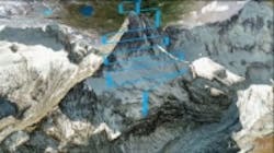
Sensefly, the creator of the lightweight, vision-enabled eBee unmanned aerial vehicle (UAV), or drone, has teamed up with Drone Adventures—a non-profit company which promotes the potential use of drones in drones in civilian applications—to autonomously map the entire Matterhorn Mountain.
|
Commercial UAVs legal, but for how long? Marsupial robotic system enables environmental monitoring of rivers The future is here: Five applications of UAV technology |
eBee drones have a 37.8 inch (96cm) wingspan and weight less than 1.5 lbs. (0.7kg ). The foam airframe drones are equipped with a rear-mounted propeller and feature a 16 MPixel camera which is electronically integrated and controlled. eBees can travel in the air for more than 45 minutes and feature USB connectivity for interfacing with the camera and on-board autopilot. The UAVs also come with Postflight Terra 3D-EB mapping software that runs off a desktop computer or laptop and processes aerial imagery into 2D maps and 3D models.
In order to map the 14,692 ft. (4,478 m) mountain, which is on the border between Switzerland and Italy, members from Drone Adventures scaled the mountain and hand-launched one drone from the top. Five other UAVs took care of mapping the lower parts of the mountain, according to IEEE Spectrum.
By setting an outline of a map on Google maps prior to launch, flight planning software enables the eBees to do their own 3D flight planning, even taking into account any mountains or obstacles that may come into play. Up to 10 drones can be used and controlled from a single base station during one mission. Each one of them will autonomously avoid airborne collisions, even going as far as to coordinate individual landing times.
View more information on the eBee.
View more information on Drone Adventures
Also check out:
UAVs guide students around MIT campus
Falcon UAV assists in Colorado flooding efforts prior to FEMA intervention
UAVs to survey mangrove jungles for mosquito detection
Share your vision-related news by contacting James Carroll, Senior Web Editor, Vision Systems Design
To receive news like this in your inbox, click here.
Join our LinkedIn group | Like us on Facebook | Follow us on Twitter | Check us out on Google +
About the Author

James Carroll
Former VSD Editor James Carroll joined the team 2013. Carroll covered machine vision and imaging from numerous angles, including application stories, industry news, market updates, and new products. In addition to writing and editing articles, Carroll managed the Innovators Awards program and webcasts.
