The future is here: Five applications of UAV technology
Unmanned aerial vehicles (UAV), or as some call them, drones, have been a hot button issue as of late. Some will tout their ability to perform certain tasks humans are unable to do, while others will argue against the potential invasion of privacy that the UAVs may create. The arguments don’t stop there, of course, but regardless – UAVs remain a popular talking point for many folks out there.
View a 2015 slideshow on UAV applications
|
Commercial UAVs legal, but for how long? Marsupial robotic system enables environmental monitoring of rivers The future is here: Five applications of UAV technology |
But whether you are pro or anti UAV, the fact remains that they do serve various purposes across a number of verticals. Here are five recent examples of UAVs performing tasks that otherwise may have not been completed.
1. UAVs created 3D model of the Matterhorn
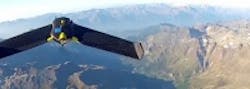
Sensefly, the creator of the lightweight, vision-enabled eBee unmanned aerial vehicle (UAV), or drone, has teamed up with Drone Adventures—a non-profit company which promotes the potential use of drones in drones in civilian applications—to autonomously map the 14,690 ft. Matterhorn mountain, which is on the border between Switzerland and Italy. eBee drones have a 37.8 inch (96cm) wingspan and weight less than 1.5 lbs. (0.7kg ). The foam airframe drones are equipped with a rear-mounted propeller and feature a 16 MPixel camera which is electronically integrated and controlled. eBees can travel in the air for more than 45 minutes and feature USB connectivity for interfacing with the camera and on-board autopilot.
View more information on the Matterhorn mapping project.
2. UAVs guide students around MIT campus
MIT’s SENSEable City Lab has developed an unmanned autonomous vehicle (UAV) system which uses GPS and cameras to guide students and visitors around the MIT campus. The system, called Skycall, allows its users to summon it via phone call and then flies to their location to guide them on to their destination. Skycall’s prototype system consists of a drone quadcopter equipped with onboard autopilot, camera, Wi-Fi, GPS navigation, and sensors that allow it to fly autonomously to specific locations. Not only does the Skycall copter have an onboard camera that provides information to the ‘base’ location upon encountering a user, but it also has a manually-controlled camera which is accessible to users via the Skycall app.
View more information on the Skycall project.
3. UAV assists in Colorado flooding efforts
Amidst the aftermath of the devastating floods in Colorado, a Falcon unmanned aerial vehicle (UAV) was deployed to create damage assessment maps to help relief agencies coordinate their efforts. Falcon UAVs are small planes which feature a gimbaled 10x zoom Sony block camera for video capturing as well as a Tamarisk 640thermal imaging camera from DRS Technologies. Tamarisk 640 cameras feature 640 x 480 pixels with a 17 µm pixel pitch. It produces 24-bit RGB output via Camera Link and weighs less than 60g, which enables it to be integrated into the UAV.
View more information on the UAV’s assistance with the flood efforts.
4. U.S. Coast Guard makes drug bust using UAVs
During a two-week U.S. Coast Guard demonstration of UAV capabilities, a ScanEagle UAV aided in the interdiction of nearly 600 kilograms of cocaine – the first time the Coast Guard has used UAVs in an interdiction operation. The ScanEagle, which was in the air for more than 90 hours, was deployed by the U.S. Coast Guard Cutter Bertholf to monitor a suspected go-fast vessel. When the UAV located the vessel, it maintained constant on-scene surveillance until the MH-65D Short Range Recovery helicopter and Over the Horizon cutter boats arrived to interdict and apprehend the vessel’s crew.
View more information on the Coast Guard drug bust.
5. Amazon unveils plans for UAV delivery service
Okay, so technically this one hasn’t happened yet, but it’s still something worth paying attention to as UAV applications continue to develop in the coming years. In this example, Amazon’s Prime Air service would see unmanned aerial vehicles (UAVs), or drones, deploy packages under five pounds (2.3 kg) to customers within a 10 mile (16 km) radius of Amazon fulfillment centers. In other words, it will drop off your latest impulse purchase right at your doorstep. (Check out a video here.) For this to work successfully, however, a number of issues would need to be addressed first.
View more information on the Amazing Prime Air concept and its potential issues.
Also check out:
(Slideshow) 10 innovative current and future robotic applications
Five food and beverage factory automation applications
Five wildlife imaging applications
Share your vision-related news by contacting James Carroll, Senior Web Editor, Vision Systems Design
To receive news like this in your inbox, click here.
Join our LinkedIn group | Like us on Facebook | Follow us on Twitter | Check us out on Google +
This article was originally published on 12/6/2013
About the Author

James Carroll
Former VSD Editor James Carroll joined the team 2013. Carroll covered machine vision and imaging from numerous angles, including application stories, industry news, market updates, and new products. In addition to writing and editing articles, Carroll managed the Innovators Awards program and webcasts.