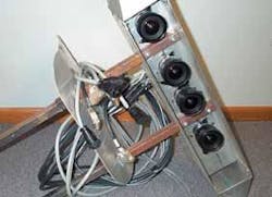
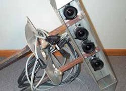
Multispectral sensor uses multiple linescan cameras
Andrew Wilson,Editor,[email protected]
The integration of geographic information systems (GISs), global positioning systems (GPSs), and digital aerial imaging provides end users with accurate, high-resolution data that can be georeferenced to within a meter and made available within 72 hours of an overflight. GPS Innovations (GPSI; Excelsior, MN) is using this integrated technology to solve problems in agricultural production and in the use of natural resources.
Using a sensor system developed by Digit (Bovey, MN), GPSI has developed a system that consists of four digital cameras and a GPS that provides data to a central flight computer. Connected to the flight computer is a display that provides the flight pilot with information about the current position and track of the aircraft with respect to the location of the photo centers for a given mapping mission. To digitize the images, four monochrome CAD4 1024A 1024 x 1024-pixel area-array cameras from Dalsa (Waterloo, Ontario, Canada) are used. The cameras are interfaced to the host PC using four AMDIG digital image-capture boards from Coreco Imaging (Bedford, MA).
"Each camera incorporates a bandpass filter that matches the first four bands of the Landsat 7 Enhanced Thematic Mapper-Plus sensor," says Charles Wivell, president of Digit. "These bandpasses are in the blue, green, red, and near-infrared (near-IR) portion of the spectrum-regions of the spectrum that relate to biophysical characteristics of vegetation. The blue and red bandpasses correspond to chlorophyll-absorption regions, the green is located at a region of high reflectance for vegetation, and the near-IR corresponds to a region of high reflectance that is associated with a plant's internal leaf structure. Because leaf structure is highly variable between plant species, reflectance measurements in the near-IR region often permit the discrimination between vegetation species," he adds.
A 12-channel Motorola VP Oncore GPS from Synergy (Washington, DC) provides the real-time information used to display the aircraft's position and track and automatically activates the cameras when the aircraft reaches each photo center. Each image is time-stamped using the GPS. Using the time stamp of the image and the GPS information, engineers can accurately determine the position and heading of the aircraft for each image.
Using the accurate position and heading information, engineers can automatically correct the image to a WGS84 Universal Transverse Mercator map product. In turn, the map product is placed into a GeoTIF format so that it can be manipulated by other off-the-shelf GIS packages. After images are captured, image-processing software analyzes and displays the images. This software was developed using Microsoft Visual C++ running under Windows 95/98/Me/2000/NT.
Currently, GPSI and Digit are in the process of incorporating an inertial navigation system (INS) into the system. Filtering the INS information with the accurate GPS information and adding a Digital Elevation Model will allow the imagery to be automatically orthocorrected and mosaicked.
"A major advantage of this system over classical photography is the quick turnaround time," says Wivell. "Because the GPS and INS information are stored directly into the flight computer, images can be processed quickly, without the need for developing, scanning, and hand-rectifying. For small projects, for example, it is possible to acquire the images in the morning and have map products available in the afternoon," he adds.

