Researchers in Japan have developed a low-cost method to inspect electrical transmission lines at close range using unmanned aerial vehicles (UAVs).
The goal is to capture images of transmission lines detailed enough to uncover issues such as signs of aging and cracking. It uses a GNSS receiver, RGB camera and mm-wave radar.
Inspecting transmission lines is challenging because of magnetic field interference, which makes it difficult for UAVs to fly close enough, within a few meters of the line, to obtain good images.
Some investigators have overcome the interference with the use of expensive high-precision sensors and other sophisticated but bulky equipment. However, these systems are unlikely to be adopted universally across the industry because of their high cost, explain the authors of the current study. From the Graduate School of Science and Engineering at Chiba University (Chiba, Japan), they describe their method in an article in Remote Sensing (https://bit.ly/4229TSF).
The Machine Vision Camera and Other Components
To obtain the images necessary for inspection, the researchers developed a custom quadcopter UAV, weighing 0.484 kg with dimensions of 0.24 X 0.24 X 0.15 m. It was fitted with a 5-in propeller and consisted primarily of a GNSS receiver, mounted on top of the UAV, and a radar and RGB camera, both of which were affixed to the bottom of the UAV. They put the main control board in the center of the UAV.
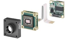
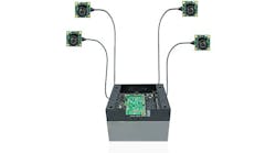
The specific camera is a 12 MPixel OAK-1 from Luxonis (Westminster, CO, USA), which can run custom AI models and perform advanced computer vision tasks. During a test flight, the camera stored HD images of the line taken during flight.
Related: Cameras and Drones Team up for Oil Refinery Pipe Inspection
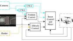
The researchers incorporated several specialized imaging and mathematical methods to keep the UAV on course during the flight.
They used a feature extraction technique known as Hough transform to identify the transmission line and measure the distance from the transmission line to the UAV. This method allows the UAV to maintain a flight path of 2 m above the line, even when there is inadequate natural light or minimal difference in the color of the transmission line and background.
In addition, a heading correction module countered magnetic field interference, which affects the UAV’s compass, by using the transmission line’s beginning and ending points to calculate the desired direction.
A waypoint correction module, which determines intermediate points on the route, addressed the mismatch between the planned and actual path of the UAV caused by the lower accuracy of the GNSS receiver. The researchers also used an auxiliary controller to address unknown disturbances during inspection, such as strong winds.
To test their system, the researchers deployed the UAV to inspect a 10 kV energized power line. During the test, the UAV maintained the 2 m position above the line and captured high definition (HD) images. However, they had difficulty detecting very small signs of damage or those located on the underside of the line.
“Our method offers a valuable reference for the cost-effective and lightweight development of transmission line inspection UAVs and contributes to promoting the widespread adoption of UAVs for inspection tasks,” the researchers wrote.
