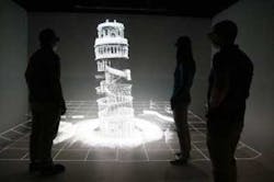
Creating 3D maps of the Leaning Tower of Pisa
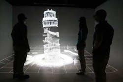
Researchers from the Commonwealth Scientific and Industrial Research Organisation, Australia's national science agency, have created an interior 3D map of Italy's Leaning Tower of Pisa by using a Zebedee 3D mapping system. The Zebedee device is a handheld 3D mapping system which incorporates a laser scanner swaying on a spring to capture millions of detailed measurements of a site as fast as an operator can walk through it. Image processing software then converts the acquired laser data into a detailed 3D map. >>>Read more.
About the Author

James Carroll
Former VSD Editor James Carroll joined the team 2013. Carroll covered machine vision and imaging from numerous angles, including application stories, industry news, market updates, and new products. In addition to writing and editing articles, Carroll managed the Innovators Awards program and webcasts.