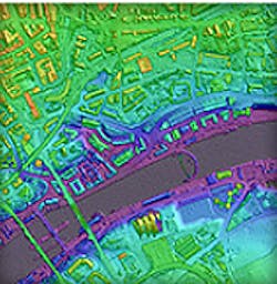
Airborne system maps the land in 3-D
Leicestershire-based aerial surveying company Bluesky (Coalville, UK) has purchased an airborne mapping system from instrument manufacturer Optech (Toronto, Canada), which includes a lidar sensor as well as a long-wave infrared thermal sensor and high-resolution ortho camera.
The system allows high precision mapping of the land and cities in 3-D together with aerial image capture and a thermal mapping capability to measure heat loss from buildings.
It is suited for applications such as electricity transmission network mapping, transport infrastructure modeling and environmental monitoring such as flood risk analysis and forestry management.
It will enable Bluesky to capture 3-D measurements from which to create maps such as its UK-wide solar potential map and 3-D city models.
"There is an increasing demand for high tech aerial surveying as it provides a rapid way to accurately map infrastructure, floodplains and urban areas," says Rachel Tidmarsh, Managing Director of Bluesky International.
-- Dave Wilson, Senior Editor, Vision System Design
